


- Description
- Solutions
-
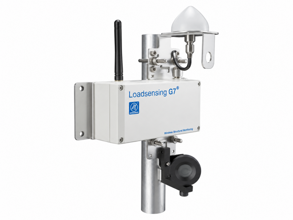
GNSS Meter
The Worldsensing GNSS monitoring system is designed for automated, high-precision monitoring of 3D ground movements and displacements of engineered structures. The solution enables continuous monitoring of absolute displacements at observation points and can be used to assess the stability and behavior of open-pit mines, slopes, tailings storage facilities, dams, landslide-prone areas, construction sites, and other locations where settlement, subsidence, heave, and horizontal movements need to be monitored.
The system is based on GNSS satellite positioning using Real-Time Kinematic (RTK) technology. GNSS Meters are installed directly at the monitoring points and receive signals from multiple satellite constellations to determine their 3D position. One GNSS Meter operates as a base with known coordinates, while the remaining devices operate as rovers at the monitoring points. The base generates RTK corrections and transmits them to the rovers via LoRa radio. Using the satellite measurements and RTK corrections, the system determines changes in the coordinates of each monitoring point, enabling precise measurement of its actual movement in three dimensions.
Low-power LoRa radio communication enables an autonomous monitoring network without cabling between monitoring points and without requiring each GNSS Meter to have a permanent cellular or internet connection. Measurement data is transmitted over the LoRa network to CMT Edge, from where it can be transferred to external systems through standard communication channels, including LAN and cellular connectivity. This architecture enables deployment at remote and difficult-to-access sites and allows GNSS monitoring to be integrated with the existing Worldsensing infrastructure and other geotechnical sensors.
The system delivers millimetric precision for 3D ground movement monitoring. For 24-hour aggregated values, the GNSS Meter provides accuracy of up to 2 mm horizontally and 3 mm vertically. Test results demonstrate that high-precision data can also be obtained when rovers are located at significant distances from the base. Measurements provide information on horizontal and vertical displacement as well as the geodetic coordinates—latitude, longitude, and height—of each monitoring point.
Collected data is available through CMT Edge. Users can access the latest readings and time-series graphs, monitor GNSS Meter operating parameters, and review ground displacement data. Measurement and device health data can also be exported in CSV format for further processing and integration with third-party information systems. CMT Edge is used to configure and manage the GNSS network, including assigning devices as a base or rover, entering the base coordinates, associating rovers with the corresponding base, and configuring system parameters.
A GNSS Meter can be configured to operate either as a base or as a rover, simplifying network deployment and subsequent scalability. Initial device configuration is performed using the Worldsensing App, while further system management is available through CMT Edge and CMT Cloud. This flexible architecture allows additional monitoring points to be added to the network and GNSS monitoring to be combined with other geotechnical instrumentation within a comprehensive monitoring system.
The equipment is designed for long-term autonomous operation under demanding industrial and environmental conditions. Depending on the operating mode, the battery life can exceed three years. The aluminum enclosure provides IP68 protection, and the equipment is designed to operate at temperatures from −40 to +80 °C. This robust design makes the system suitable for remote installations while minimizing maintenance requirements.
Data communication uses the sub-GHz ISM band with LoRa/LoRaWAN technology. Communication between the device and the gateway can reach up to 15 km under line-of-sight conditions and up to 4 km in urban environments, while the stated line-of-sight communication range between the base and GNSS rover is up to 5 km. Bidirectional communication enables both measurement data transmission and remote configuration of GNSS devices.
By combining GNSS satellite positioning, RTK corrections, low-power wireless data transmission, and autonomous battery operation, the Worldsensing GNSS Meter provides long-term automated monitoring of 3D ground movements without the need for complex cabling or power infrastructure at each monitoring point. The solution is designed for applications where millimetric precision, autonomous operation, large monitoring areas, and scalable network deployment are critical.
-
Main Areas of Application:
- Discover key applications where our solutions deliver precision and reliability for 3D ground movement monitoring

Leave a request — we will find
a solution for your facility
We will contact you, discuss the details and find a format
that is mutually beneficial.